Walnut Creek Study
A couple friends and I (both Genealogists) have been researching the Walnut Creek area between Tarboro and Rocky Mount. I have previously mapped this area and became overwhelmed with deeds. Too many deeds…so I decided to step back and just do the first patents. The idea was to have a solid base to build upon and allow us to have a focal point for the later smaller deeds to then make sense in all the confusion. I am pleasantly surprised how well it is going…I have over 30 patents so far… note how snugly most of them fit together…
Interactive Patent Map
Open the full-screen interactive map — or explore it right here. Click any patent for its status and citation; the top-right control toggles individual patents, top-left toggles the 1903 USGS topo.

I am the mapper of our little group and as my friends were feverishly coming up with intriguing clues to our genealogy questions, I was finding it impossible to find where their various properties actually existed beyond just a vague guess. So I decided to get a bit more accurate. Above is a USGS 1903 topo map but the base map under it is a modern GIS similar to Google satellite maps. The takeaway is that these are pretty damn accurate. Think of driving around in your car or boat with the GPS thingamagig explaining you just missed your right turn.
Then I saw it.
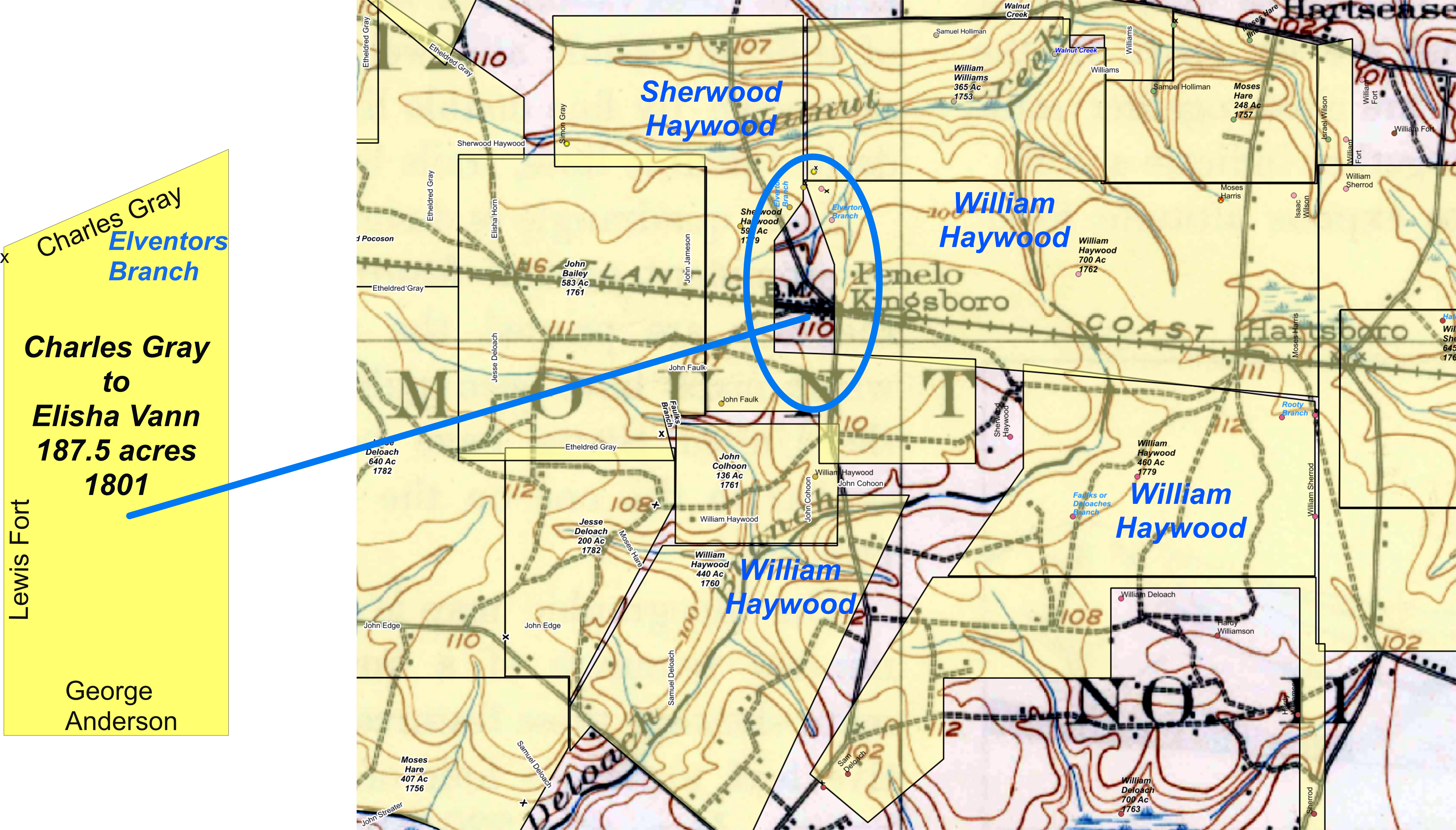
That gaping hole between Sherwood Haywood and William Haywood’s patents is a DEED… not a patent. Remember this map is only original patents. The only folks who claimed the land before these patents were Indegenes (Indians for you non politically correct dirtbags). But try as I might, there is no patent to be found. So I went searching for evil white criminal thieves… found ’em to.
A suspicious person might conclude that William Haywood was a crook. Tsk tsk…he was just a County Surveyor… and it seems that those boys had a license to steal.
The torturous file below shows my journey to discover a marvelous bit of magic that the Haywoods, et al, skillfully performed to acquire over 400 acres of land in Edgecombe as they hightailed it to Raleigh in pursuit of more advantageous adventures than farming. (afterwards, Click the file Color of Title 2 to see the marvels of Magic Patents)
A map below breaks down Walnut Creek and its branches including Elverton/Elvington, Middle Prong, Cesar’s Branch. Faulk’s Branch and also includes Deloache’s Branch… most of these I have identified. However Cesar’s Branch eludes me. All of these are important because they are key to locating deeds.

Gray C to Battle J 1807 1135 wc
This is the full version of the Cesars Branch Study…this is only for serious OCD nerds like me. (which is why I inserted the 6 grade level version in the previous file…it was not to be insulting; it was to make it simple.)
_______________________________________